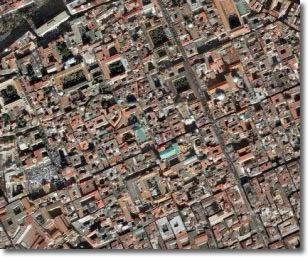
- Satellite image of the historical centre of Naples (Google Maps photo)
To the right of the Forum (Piazza S. Gaetano), we walk on until we reach Via Duomo, where we see the archaeological remains of a Roman "domus" (household), conserved in the basement of the Banco di Napoli's Record Office. This is testimony to probably building activity around the ancient Campania gateway that shut off the Main Decuman (today the site of the offices of the Law Courts), the thermal baths of S. Carminiello ai Mannesi and the excavations of the Duomo, or Cathedral.
The thermal baths were discovered by chance in the 20th century during clearance of the debris after an air raid. Initial disinterest and consequent lack of care lasted until the late 1980s, when archaeological digs began again and a whole complex of Roman buildings was discovered: a Roman household of the Republican period, an area dedicated to the god Mitra, a cult of Persian origin widespread among the military, and a thermal baths complex above the others, this built during the time of reconstruction in the imperial era, towards the end of the 1 century AD.
The archaeological area of the Duomo is situated beneath the Cathedral where one can clearly see Roman constructions of the imperial age, the remains of a road of Greek times which separates thse excavations rom the area of the Byzantine or late Roman era with what is left of floors, the bases of columns, wells and a small apse adorned with mosaic flooring.
Further north, in Via Duomo we come to the last decuman, the Upper Decuman. To the right, this coincides with the present-day Via di Donnaregina and Via degli S.S. Apostoli, where the eastern gateway called Porta Carbonara and later porta S. Sofia used to be. To the left the decuman coincides with the present-day Via dell'Anticaglia and Via Pisanelli. Here the archaeological remains, of the theatre above all, are partly visible. There are sites of interest inside basements and convent courtyards, but they are not easily accessible to tourists.
Turning into one of the narrow streets to the right, we come to the high part of the city, the Acropoli, which corresponds to Largo S. Aniello a Caponapoli where the hill used to be much higher than the present one and the walls of which ran upwards. Parts of them can still be seen.
The Acropoli was the place of the most important temples where the basic religious rites were performed, the gods were worshipped and processions and sacrifices took place. The high slopes of the hill ran steeply down towards the valley, forming a kind of rampart of natural defence against any attack from the Campania hinterland.
In present day Via Foria, there was a valley where the rainwater from the nearby hills flowed into the sea. Nothing special is known about the River Sebeto, but its waters and the ditches that were dug must have isolated and protected the Acropoli.